South Kaibab Trail was added to Your Favorites!
Grand Canyon NP, Arizona
Claim this place to tell your story your way.
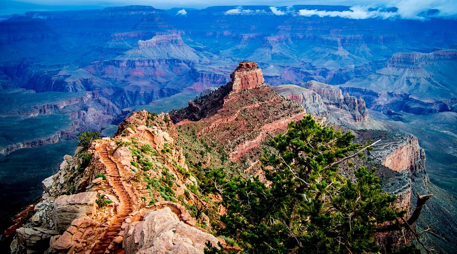
Unlike other trails, the South Kaibab Trail follows a ridge line, providing hikers with panoramic views of the canyon throughout the hike.
The South Kaibab Trail was constructed in the 1920s by the National Park Service to provide an alternative to the Bright Angel Trail, which was privately owned at the time.
The name 'Kaibab' comes from the Paiute word 'Kaivavits,' meaning 'mountain lying down,' referring to the Kaibab Plateau.
The South Kaibab Trail is approximately 7 miles long with an elevation change of about 4,780 feet from the rim to the Colorado River.
Hikers on the South Kaibab Trail can observe distinct geological layers, including the Kaibab Limestone, Coconino Sandstone, and Redwall Limestone.
The trail is home to diverse wildlife, including mule deer, bighorn sheep, and the endangered California condor.
The trail is best hiked in the cooler months of spring and fall to avoid the extreme summer heat and winter snow.